
Advanced Tools for Environmental Quality
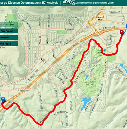
Matrix provided GIS services to the Arizona Department of Environmental Quality (ADEQ), who was in need of a screening tool to assist them with making permitting and compliance decisions under the Clean Water Act Program. The tool would be used for determining the potential of discharges from non-jurisdictional waterways to reach a regulated Waters of the United States (WOTUS) jurisdictional waterway within Arizona. Matrix, with assistance from our partners, developed a web-mapping application that allows ADEQ analysts to select a discharge point on a map, enter the parameters for the discharge, and then print a report outlining the path and length of the discharge.
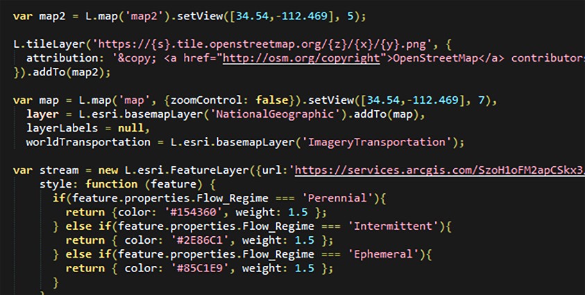
The web-based mapping application was built using Leaflet, Calcite Maps, Bootstrap, Esri ArcGIS API JavaScript, Turf.js, and jQuery. The USGS StreamStats Flow (Raindrop) Path application served as the basis to determine initial runout where no parameters are introduced. Once this path is determined, the analyst can use the Turf JavaScript editing tools to refine the runout path. Once complete, the runout path is then run through the equation to determine the length of the ultimate runout. The runout path is segmented at that distance and segmented to create a new dataset depicting that length.
Services Provided:
- GIS Services